The River Evenlode rises near Moreton-in-Marsh, Gloucestershire, and is a headwater tributary of the River Thames, with a catchment area of approximately 430km². The landscape is predominantly agricultural, consisting of arable land, grassland and woodland.
Case study area
16 km² catchment
Climate and soil
Atlantic central
Loamy clay soils
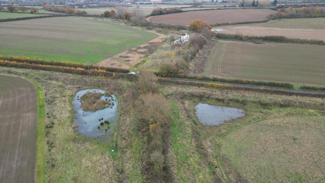
Sponge measure
Surface water
(Online ponds)
1. Challenge
Land drainage in particular has resulted in the straightening of the river channel, and some of the local villages are at high risk of flooding due to the altered and restricted course of the river. The catchment also suffers from degradation due to pollution from waste water and agricultural runoff. The clay soils of the Evenlode headwaters are an important landscape feature of the north west of the catchment. The increase in impervious surfaces (roads, housing) and the compaction of soils from heavy farm machinery reduce the amount of water that can infiltrate into the subsurface soils, resulting in increased flood risk.
2. Type of sponge measures
The objective is to improve our understanding of working with natural processes for flood risk management in an agricultural landscape. Natural Flood Management was trialled in Littlestock Brook (16 km²) in the Evenlode catchment during a 5-year project (2016-2021). It was one of the first of its kind in the Thames Basin. The measures aimed to retain and store more water across the catchment to slow the flow (through field corner bunds, woodland planting, leaky woody dams and inline ponds) and improve water quality, ecosystems services, habitats and carbon sequestration (through nutrient retention ponds, planting of riparian woodland, restoration of wetlands).
3. Monitoring
Long-term hydrological data (1970-) and calibrated hydrological models. Data was collected by the project since 2016 including: measured water levels, flows, turbidity, sediment and nutrients, pond vegetation and macroinvertebrate species. With a combination of low-cost and high-tech monitoring to analyse the impacts from the plot scale to the catchment scale.
4. Stakeholders
The case owner, Wild Oxfordshire (Evenlode Catchment Partnership host organisation), is coordinating the collaborative efforts of landowners (including farmers changing their farming and land management practices), local communities, and Environment Agency.
5. Reference information
Wild Oxfordshire (Evenlode Catchment Partnership) (Case study owner)