The municipality of Santorso (see also related case studies 10 and 11) is located near the Venetian Pre-Alps, crossed by the Leogra and the Timonchio rivers and artificial channels crucial for historical manufacturing, irrigation, and runoff control. The case study is located in the Veneto region that signed the Mission Charter of the EU Mission on Climate Adaptation.
Case study area
0,004 km² urban site
Climate and soil
Mediterranean mountains bio-region
Sandy clay loam soils
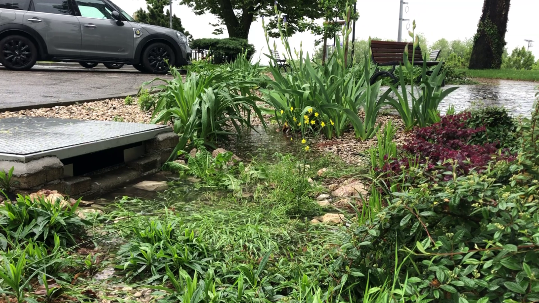
Sponge measure
Surface and groundwater
(Rain garden)
1. Challenge
In Veneto, Italy, floods, landslides, and erosion have significantly affected the region. Municipalities face increased flood risks due to rising land consumption, more in northern Italy. Santorso and Marano Vicentino, in Vincenza's north, use sponge measures to counter pluvial flooding and improve rainwater management. The main objective of the case study is to analyse the impacts of the widespread adoption of the sponge measures in such a heterogeneous, anthropised environment.
2. Type of sponge measures
Sponge measures include rain gardens, bioretention, grassed swales, and pervious pavements and an inflitration trench.
3. Monitoring
From 2020, the sponge measures are being monitored to accurately assess the effectiveness of the measures in terms of water retention and infiltration.
4. Stakeholders
Municipality of Santorso, University of Padua.
5. Reference information
Municipality of Santorso (case study owner)
Department of Land, Environment, Agriculture and Forestry of the University of Padua