The growing challenge of drought
Drought is a growing concern in the Upper Biebrza River Basin in Poland. It is affecting the entire region: both agricultural and wetland ecosystems. Water levels in rivers throughout the catchment have been very low for a long time. In particular, on the Biebrza River at the Sztabin gauge - which closes the Upper Biebrza catchment - the water level has reached a record low of 92 cm on 25 September 2024.
SpongeScapes' Polish partners at the Warsaw University of Life Sciences are conducting detailed studies in this region to understand how different landscapes shaped by different activities and land uses retain water differently. They are tring to understand how the area's ability to act as a sponge can be enhanced, especially in the face of intense climate change.
Comparing two different landscapes
In the Upper Biebrza catchment, intensive agriculture dominates the landscape and is becoming more intensive every year. In contrast, the Biebrza Valley within the National Park is characterised by more extensive agricultural practices, with a mosaic of mown plots and sections left to natural succession and vegetation growth.
The Polish team is particularly interested in comparing different watercourses to understand the impact of different river management practices on water retention. On one side is the River Biebrza, which flows through an extensively used valley and has not been subject to maintenance. On the other hand, the Olszanka and Brzozówka rivers (two tributaries of the Biebrza) flow through intensively used agricultural areas that are heavily drained. Here, maintenance works such as mowing the vegetation in the river channel and banks or deepening the channel are carried out routinely.
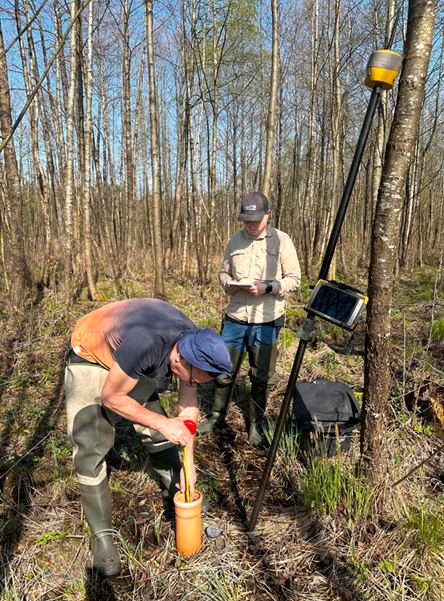
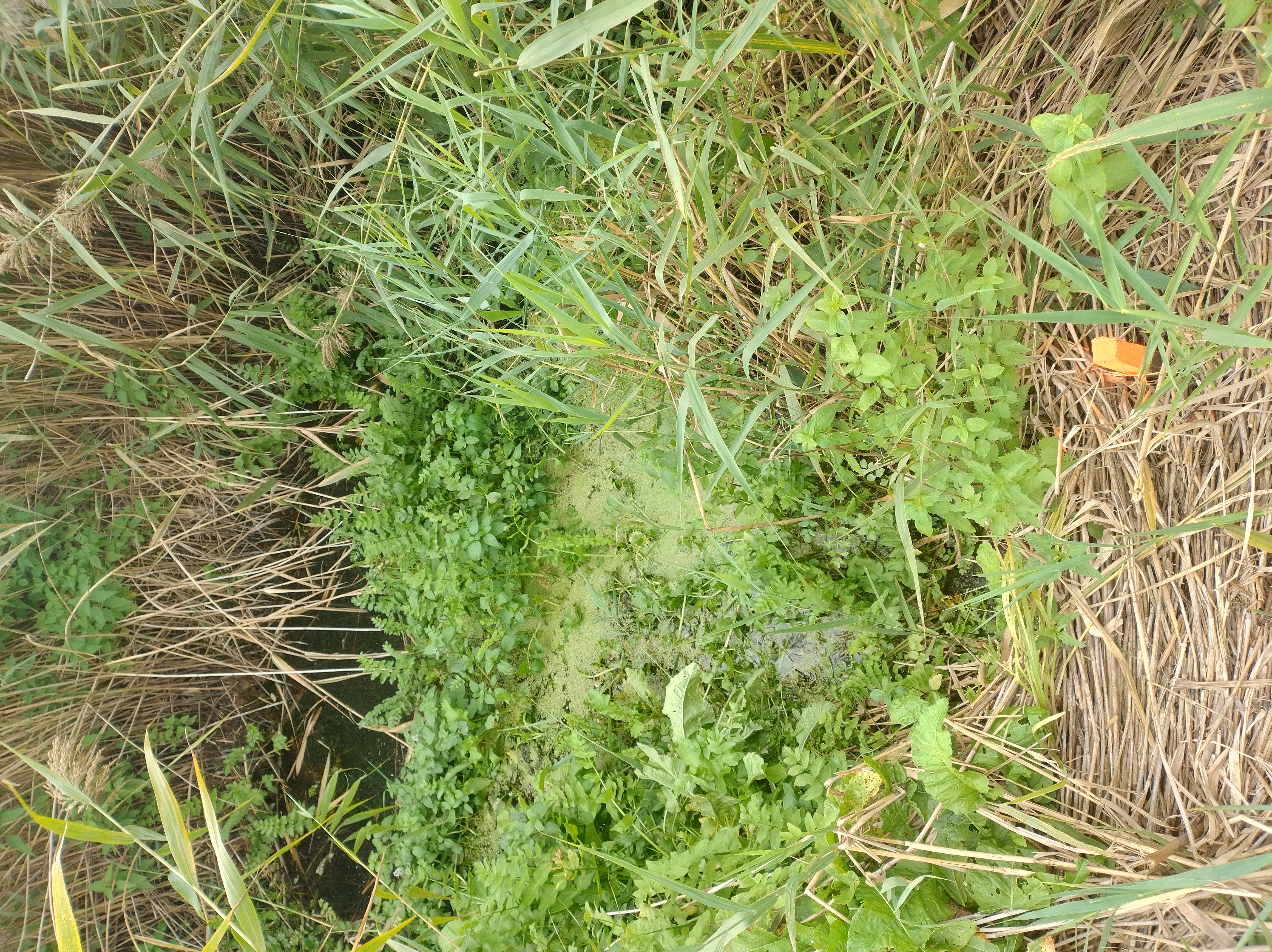
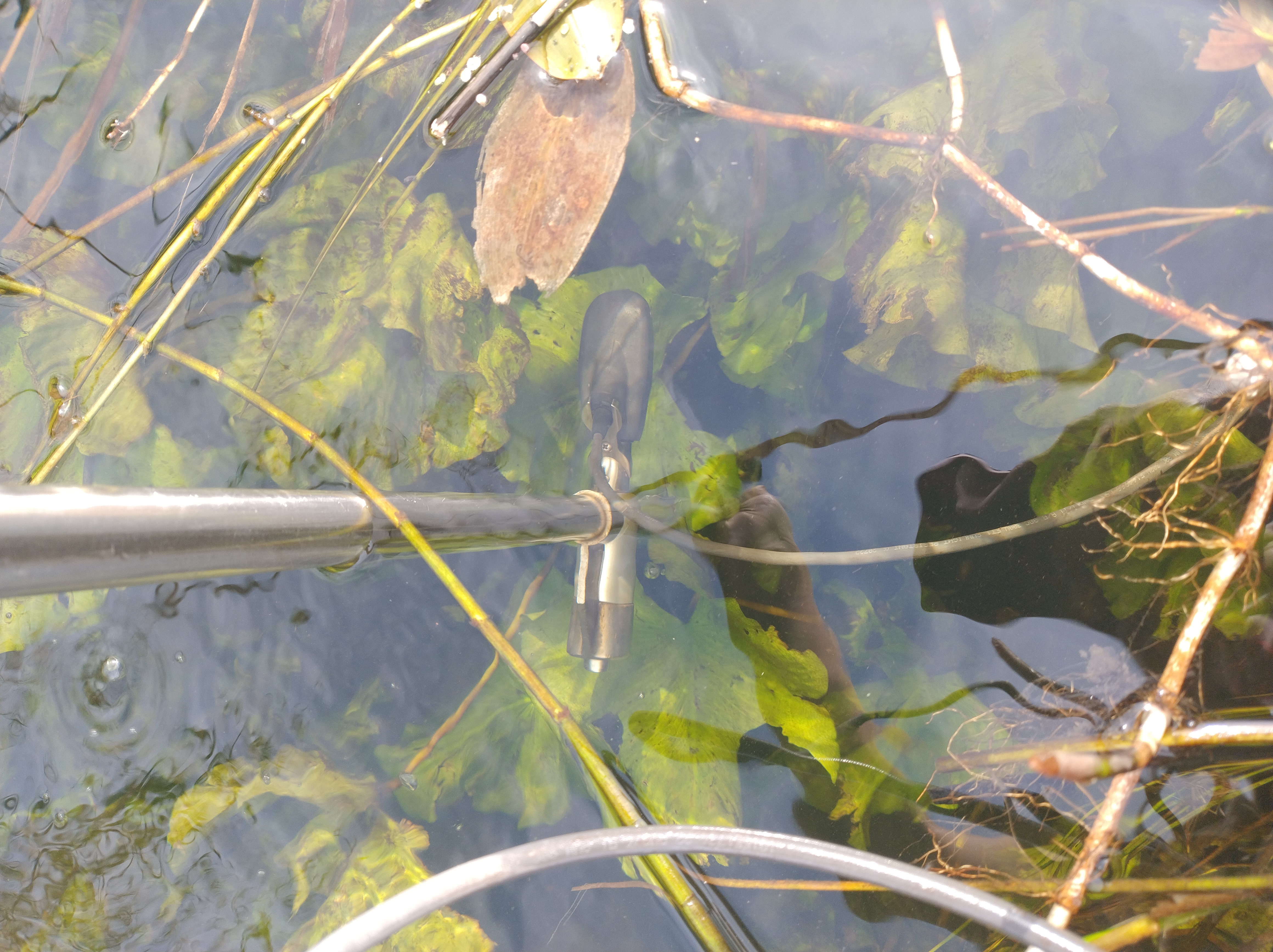
Groundwater monitoring: how well is the landscape acting as a sponge?
Groundwater monitoring provides a direct assessment of an area's ability to act as a natural sponge by tracking water level fluctuations. This provides a better understanding of the wetland's ability to retain water. Using piezometers and DT-Divers (Figure 1), the Polish researchers are able to track fluctuations in water levels, providing critical insights into how the area manages water retention during droughts and how this affects flood dynamics or water storage.
The data collected will help optimise the placement and design of potential future sponge operations. It shows their potential benefits for water storage or biodiversity.
Monitoring also highlights trade-offs, like conflicts between improving water retention in an area and agricultural practices such as mowing. For example, high groundwater levels or the presence of surface water may make mowing difficult or impossible for farmers.
 |
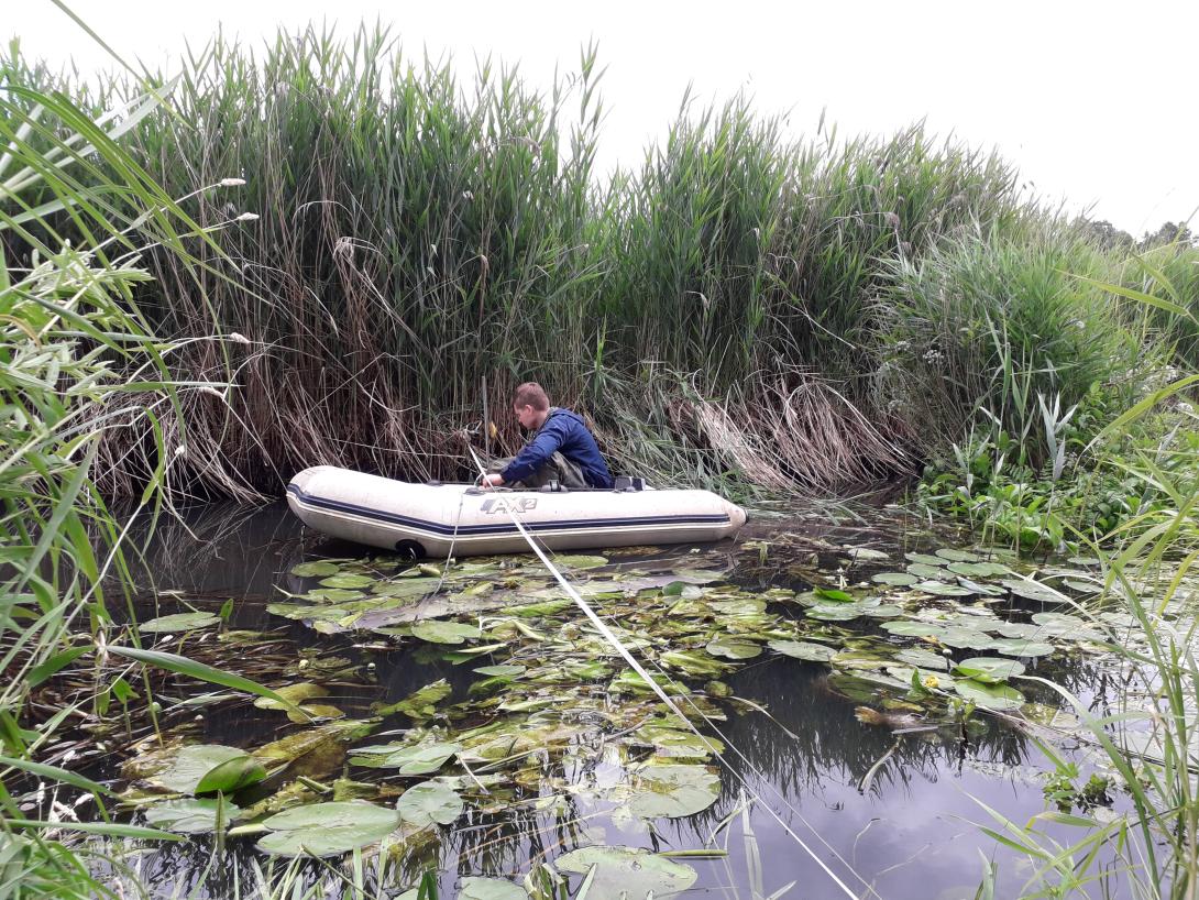
Monitoring river vegetation: how plants slow water flow and increase water retention
Other measurements carried out on the Biebrza River and its tributaries provide valuable data on how vegetation affects water flow and levels during the growing season. Aquatic and riparian vegetation increases channel roughness, leading to a reduction in flow velocity and an increase in water levels, thus increasing water retention in the landscape.
In order to investigate how maintenance activities such as vegetation mowing affect channel retention, the team is comparing areas where river vegetation is allowed to grow naturally (such as the Biebrza River) with areas where it is regularly cut back (such as the Brzozówka and Olszanka Rivers). Measurements are being taken on three stretches of the Biebrza River (Figure 2), serving as a reference site, and on two of its tributaries, the Brzozówka and the Olszanka, where maintenance activities are carried out.
This comparative analysis allows Polish researchers to demonstrate the important role of vegetation in water retention, to identify and present differences resulting from different management practices, and to develop improved management strategies for the rivers and their surrounding landscapes.
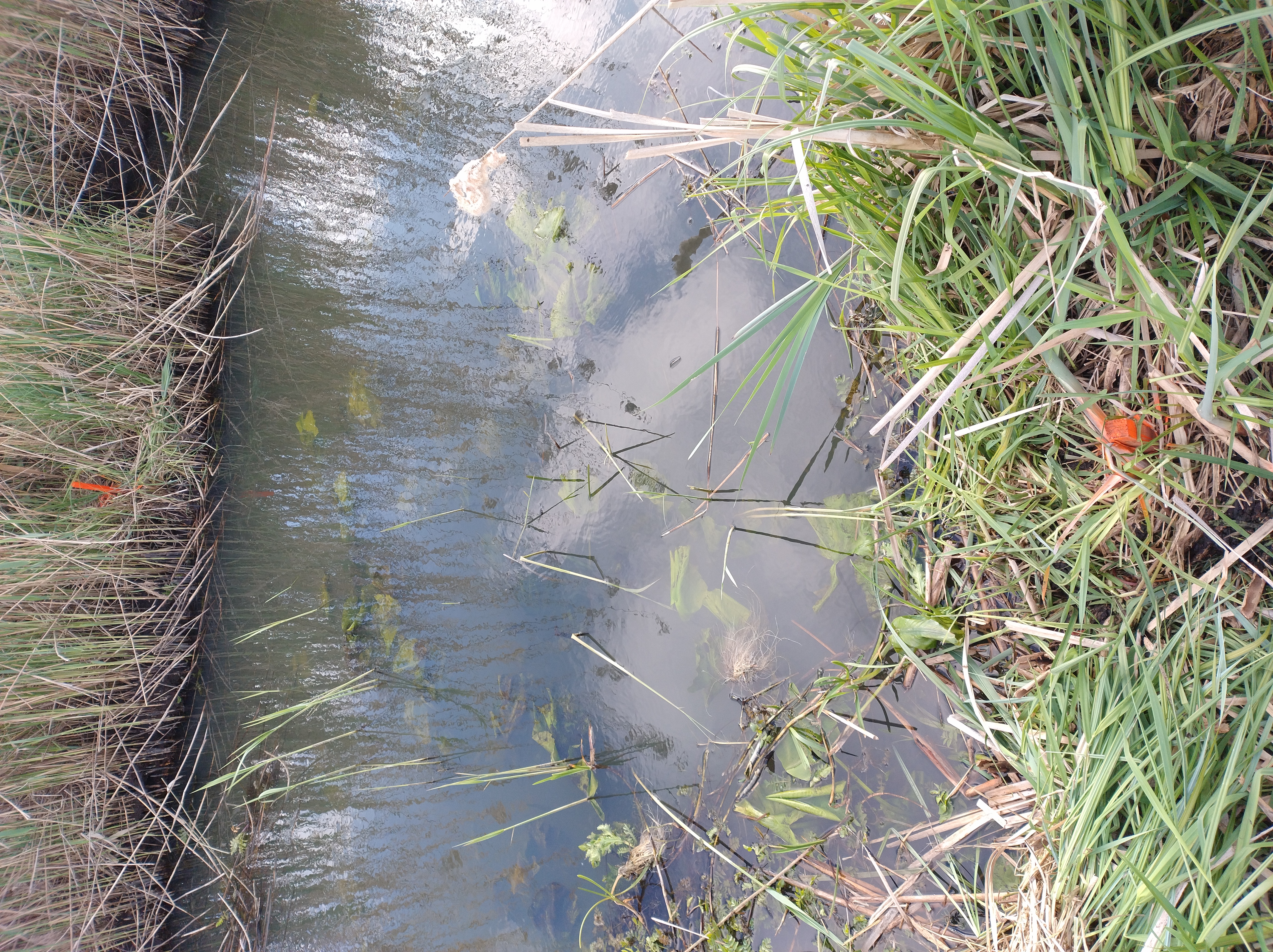 | 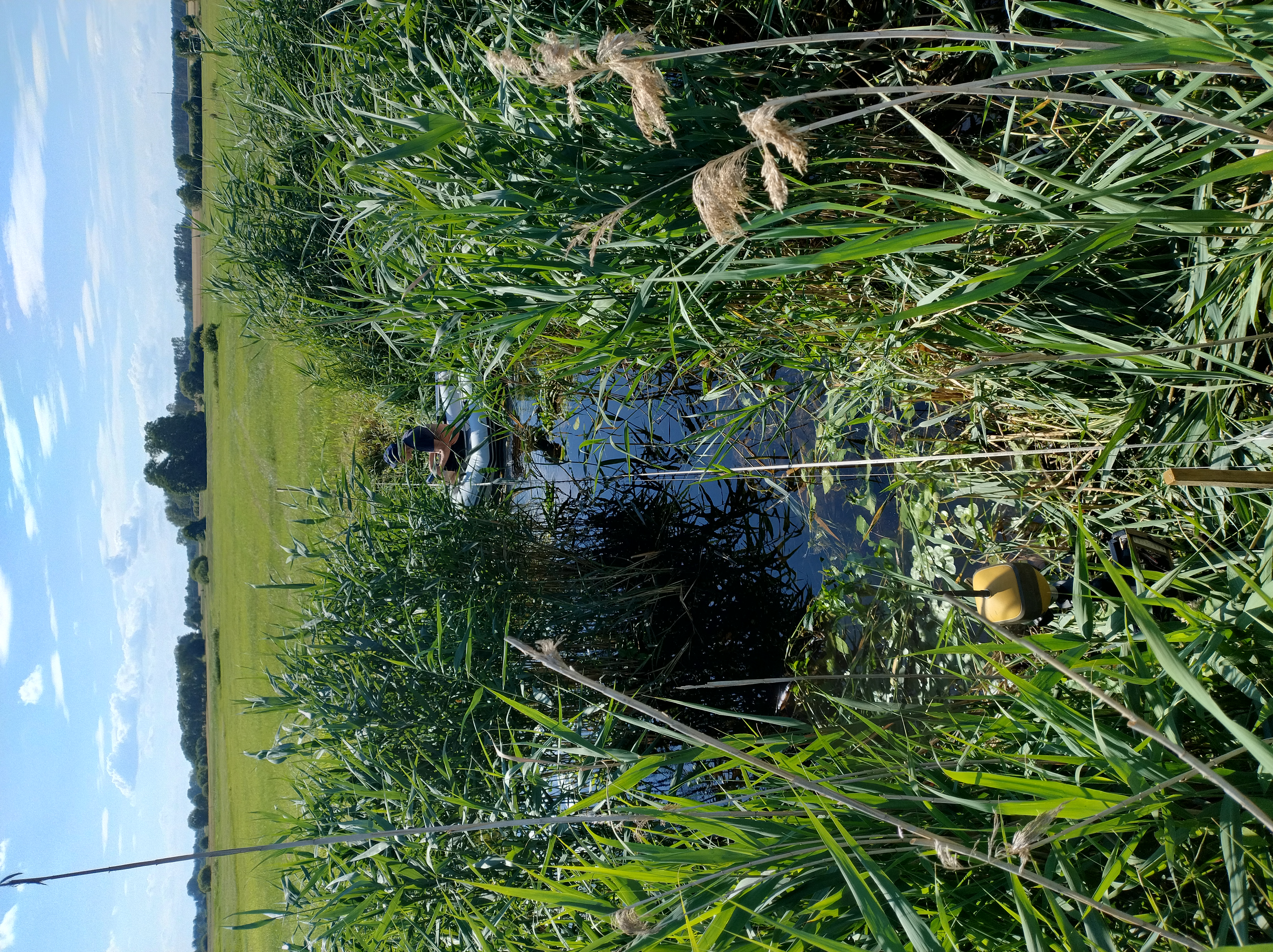 |  |
Using a hand-held electromagnetic water flow meter (Figure 3), the team is measuring water velocity and assessing changes in channel roughness (Manning coefficient) as a result of vegetation growth and mowing. Measurements are taken at cross sections at the beginning and end of the river reach. Between 50 and 100 point measurements of water velocity at different depths are taken at each cross section. In addition, the position of the cross section, the surface water level is measured using GPS RTK (TOPCON model HiPer HR) and a control survey of the slack water is carried out using a levelling instrument (TOPCON model AT-B).
 |
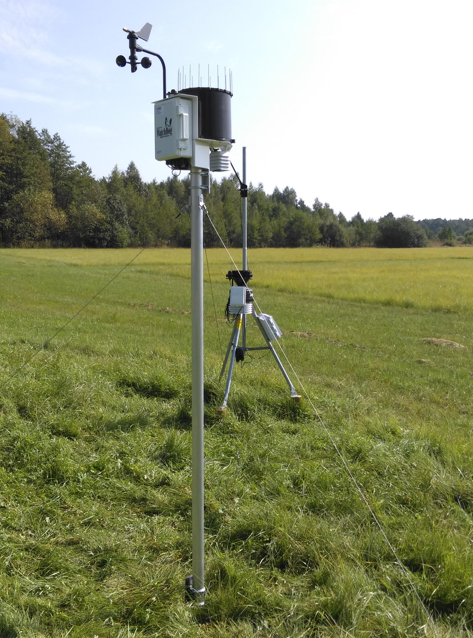
Monitoring rainfall and evapotranspiration: understanding the bigger picture
In addition to hydrological data, meteorological parameters such as precipitation, temperature, humidity, wind speed and solar radiation are monitored by an automatic weather station. This information helps researchers understand the water balance in the region, particularly the relationship between precipitation (water input) and evapotranspiration (water loss). This understanding is vital for managing water retention in the area.
Each month during the growing season, Leaf Area Index (LAI) measurements are also taken to assess the vegetation cover in the Biebrza River valley. This analysis helps to determine how the canopy regulates evapotranspiration and interception, thus influencing the overall health of the wetland ecosystem.
 |
Conclusion: guiding future water management
The comprehensive monitoring efforts in the Upper Biebrza catchment provide crucial insights into how different water and land management practices - intensive agriculture coupled with river maintenance activities versus wetlands with low management activities - affect water retention, flood dynamics and biodiversity. These findings will guide future actions aimed at improving the region's ability to act as a natural sponge, reducing the impact of droughts and floods, while balancing the needs of local communities and agriculture.
For more information, visit the case study page.